Seabed mapping and route planning
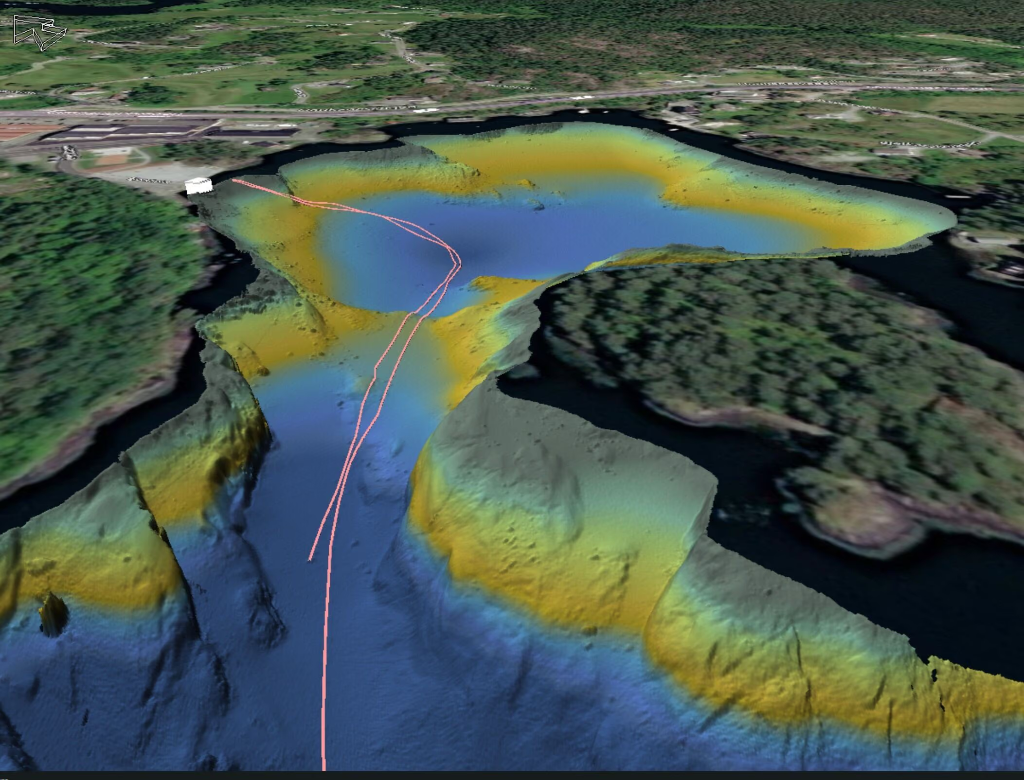
We map the seabed and plan cable routes based on actual conditions, helping you reduce risk, cost, and errors during implementation.
What questions we answer
Where is it safe and appropriate to lay my cable? What conditions could cause problems for my installation or operation? How do seabed conditions, topography, and currents affect my solution?
What are the consequences of an incorrect route choice? How do I ensure the lowest possible total cost over the lifetime?
We conduct systematic mapping and analysis of the seabed to ensure optimal cable route. The work includes assessing seabed conditions, topography, current conditions, existing infrastructure, and potential conflict areas. We identify risks such as exposure, instability, and mechanical impact, and recommend the optimal route, installation method, and need for protection.
Seabed mapping and route planning are relevant before establishing a new cable, where detailed insight into seabed conditions, topography and existing infrastructure is necessary to ensure the correct route selection.
The service is also crucial when evaluating alternative routes, where different solutions must be analyzed and compared regarding risk, feasibility, costs, and environmental impact. Furthermore, seabed mapping and route planning are particularly important in areas with challenging conditions, such as complex seabed structures, significant depth variations, strong currents, or dense infrastructure. In such situations, the service helps reduce uncertainty, optimize the choice of solution and ensure a robust and future-proof Cable Installation.
What you'll receive
- Seabed Mapping
- Risk Analysis
- Recommended Route and Method
- Documentation
Få direkte kontakt med våre lokale team
Vi er der prosjektet ditt er
Inquiry received
Thank you for contacting Submara.
We have registered your request, and the relevant specialist will contact you shortly.